LitterMeNot logoLitterMeNot
HomeReportMapResourcesCommunityArticles
Sign inCreate accountReport now
Report

Quick navigation

Site menu

Want a profile and saved progress?
Sign inCreate account
HomeReportMapResourcesCommunityArticles
AboutSafetyProvidersGroupsFAQContactMediaSupport

Use the map to check nearby pins first, then report only when the spot still needs to be added.

Open report
LitterMeNot logoLitterMeNotReport litter, read the map, and move cleanup forward.

Use LitterMeNot

Report litterMapResourcesProviders

Learn and participate

GroupsCommunityArticlesImpact

About and help

AboutSafetyFAQContactMediaSupport
ModerationAccessibilityPrivacyTerms
© 2026 LitterMeNot
Public litter reporting

Report litter while you are still there.

LitterMeNot is built for a quick phone report. Take the photo, confirm the spot, and send it without digging through extra steps.

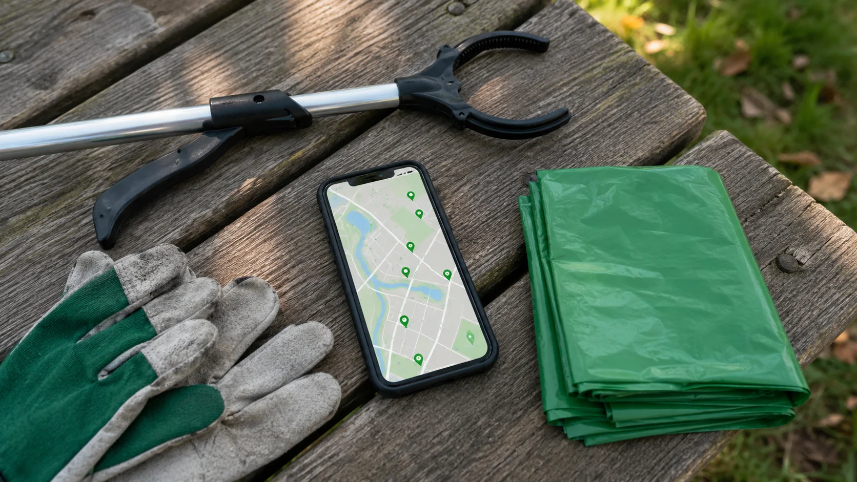
No account needed. Start with a photo, let the pin attach, and only use the map when the same area keeps coming back.

Report litter nowCheck the mapNew here? Start here →
31mapped reports
30photo-backed reports
3active areas
Latest activityRoadside report in postal area 27650last month · photo-backed
Person using a phone to document litter along a public sidewalk before sending a report
How it works

Three steps. No extra clutter.

1

Open the camera

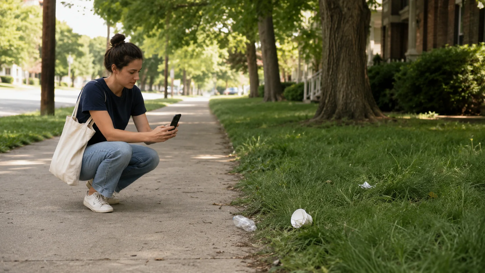
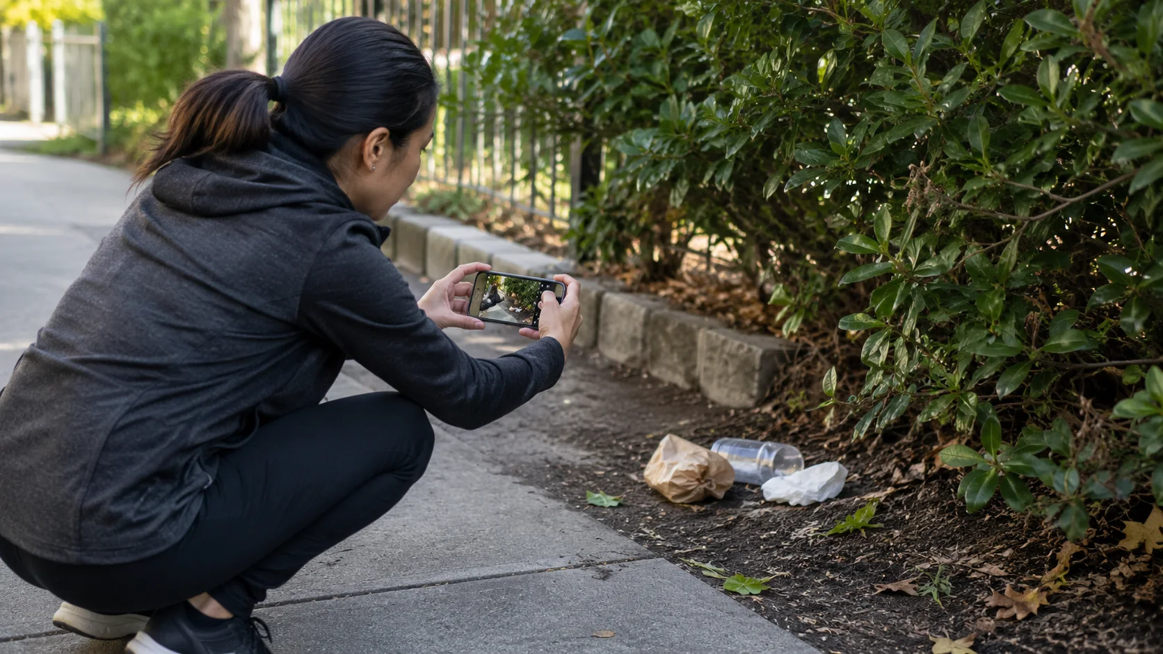
Start with the photo while you are already there.

2

Confirm the spot

Let the pin do the work first. Add detail only if it helps.

3

Send the report

Send it. Then use the map or resources only when the spot needs more follow-through.

Needs attention now

What deserves a quick check right now.

One glance shows the newest public report, the strongest repeat report area, and the cleanest next step when one map pin is not enough.

Fresh report

Active Roadside in postal area 27650

A new public report with photo proof just landed. Reopen the map while the details are still fresh.

last monthPhoto-backedMap-ready
Reopen map →
Repeat report area

Roadside litter keeps building back up

21 mapped reports are clustering around the same area. This is the best place to recheck before the pattern gets ignored.

Postal area 2753721 reports21 photos
Check area →
Cleanup path

Turn repeat spots into a cleanup route

Seasonal roadside cleanup program is the fastest route when one report is not enough and a recurring trouble area needs people, timing, and a clearer next step.

Regional / county-supportedEvent-based
Phone-first reporting

Photo-first reporting that feels obvious.

The report flow should look and feel like the task itself: photo first, location second, short details only when they help someone find or fix the spot.

  • Quick photo capture
  • Simple location fallback
  • Short note only when useful
Open report flow →
Person safely photographing litter beside a public sidewalk for a report
Cleanup gloves, bags, grabber, and phone map prepared for checking reported litter locations
Live mapOpen full map →

See patterns before they get ignored.

The map should make repeat trouble spots easy to recognize, not bury them inside a long list of separate complaints.

Most active nearbyMapped repeat areas worth checking first
Roadside litterPostal area 27537 · 21 reports
Active
Roadside litterPostal area 27536 · 9 reports
Active
After the reportView resources →

Keep the next step close.

Use the resource page when the question is simply where to take it next.

County transfer stationHenderson, NC
Transfer
Highway 39 convenience siteHenderson, NC
Convenience
Community helpView groups →

Use groups when one report is not enough.

Point people toward local cleanup help without turning the home page into another directory.

Seasonal roadside cleanup programShort, coordinated cleanup days with a clear supply path.
Group
Recurring corridor adoptionLonger-term roadway stewardship for litter-prone stretches.
Group
Ready to send a spot?

Open the report flow and send it in under a minute.

Start with one clear action: report a spot, check the map, or find the safest next step.

Report litter nowSee the map first →Choose the right path →
County- or event-coordinated cleanup days
View cleanup routes →